Beaches, bugs and plastic in Arctic Canada
15 September 2022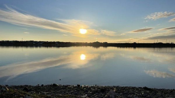
by Huw Griffiths, Cath Waller and Steve Roberts
The Arctic is undergoing dramatic changes, including unprecedented decline in sea ice and rising temperatures. These changes are likely to have significant impacts on all Arctic ecosystems, but beaches are often the places we see these changes first. In addition to these pressures, emerging threats such as plastic and other pollutants are impacting marine life all around the world from the poles to the equator.
Our team includes researchers from the British Antarctic Survey (Huw & Steve) and the University of Hull (Cath) (you can meet the team here). Our INTERACT funded project is called “Biodiversity and Plastics in Arctic Intertidal and Nearshore Terrestrial Systems” or “B-PAINTS”. INTERACT is an Arctic network of 68 terrestrial field bases in northern Europe, US, Canada, Greenland, Iceland, the Faroe Islands and Scotland as well as stations in northern alpine areas. INTERACT specifically seeks to build capacity for research and monitoring all over the Arctic, offering access to numerous research stations through the Transnational Access Program.

For our current project we headed off to Nunavut (ᓄᓇᕗᑦ) in Arctic Canada to spend two weeks working at the Canadian High Arctic Research Station (CHARS) in Cambridge Bay/Iqaluktuuttiaq/ᐃᖃᓗᒃᑑᑦᑎᐊᖅ. Situated 180 miles (220 km) north of the Arctic circle, Cambridge Bay has a polar climate and sea ice in the bay for much of the year. Being based in the UK, we faced a two-day, 9,300 km, journey at the start of August 2022 to reach CHARS. Our plan was to survey the intertidal zone (the beaches) and nearby areas for biodiversity (the plants and animals that make the beach their home). We also planned to assess human impacts, including micro (small plastic pieces less than five millimetres long) and macro (larger pieces) plastics.
To do this, we use a combination of visual surveys (images from a drone) and collections of sand and filter feeding animals (clams, crustaceans etc) to check for the presence of plastic particles. This work will add to our information that we have already collected in Antarctica, the sub-Antarctic, Greenland and Iceland, helping us to understand how biodiversity and pollution are changing in the polar regions. We had a busy couple of weeks with 110 sampling events collecting drone images, dust and beach sediments, sea and tap water sampling, and biodiversity observations and collections (see the map below for where we went).

The waters of Cambridge Bay are frozen for most of the year, making the beaches an inhospitable place for most types of life. Unlike most rocky shores around the world, Cambridge Bay has no intertidal seaweeds and very few species of animals found on the beach. The last published survey from 1961 recorded only a single species of animal from the beaches of Cambridge Bay, the amphipod crustacean Gammarus setosus. We found this species in large numbers and a few examples of another species of amphipod and some mussels. This very low biodiversity is probably a result of the continual scouring of the beach by ice for most of the year, but the deeper waters of the bay are known to support a rich diversity of seafloor life.

As well as studying biodiversity, we were looking for microplastic pollution in the air, dust, beach sediments, animals and water. Unfortunately, microplastics are known from all regions of the Earth and Cambridge Bay is no exception. Our preliminary results have found what appear to be plastic fibres and particles everywhere we have looked. We hope to use our samples to build up a picture of the pollution hotspots around the bay.

We used our multispectral drone to survey the beaches from above for biodiversity and larger pieces of plastic. The drone can cover a far larger area than humans during the limited time that the tide is at its lowest point. The drone images highlight the lack of any large plant life in the shallowest waters of the bay compared to the bright red hotspots of the plants on land and seaweeds underwater further offshore.

Our working locations were beautiful, especially the evening fieldwork provided us with some stunning sunsets. The local people were really friendly, and the children very enthusiastic, even helping us spot jellyfish and comb jellies from the dock when plankton sampling between low tides. A real highlight for the team was presenting a talk about Antarctica to a group of children from the Actua summer camp being hosted at CHARS, followed by a long chat about the animals that live around the South Pole and who eats who in the Southern Ocean.
We came to Cambridge Bay looking for microplastics, but one thing that was obvious on the beaches were the macroplastics (bigger pieces of plastic litter). Every beach we looked at had as much, or more, plastic litter than you would find in heavily populated areas of the world. These larger plastics will, if not removed, eventually break down into microplastics and chemical pollutants that can enter the environment and food chain. We are hoping that our results will help to change attitudes and policy in the region, and to encourage recycling and safe disposal of these long-term pollutants.

In the short time we had on our visit we were fortunate enough to meet and be welcomed by many local people and talk with them about their Arctic home and their perceptions of pollution and climate change. We were treated to a traditional fire lighting ceremony from a local elder and throat singing from Kalinda and Victoria during a visit from the Canadian Minister for Northern Affairs, the honourable Dan Vandal. The fabulous Helen and Pam at the Pitquhirnikkut Ilihautiniq / Kitikmeot Heritage Society told us about their experiences of changes in wildlife distribution and the new arrivals such as the moths that weren’t this far north a few years ago.

We were also treated to some delicious local sweetened bread and tales of changes to the abundance and timings of the local Arctic char (the iconic fish species that gives the bay its Inuit name: Iqaluktutiaq, meaning “good fishing place”) by an Inuit woman and her son who were at their fishing cabin on the south coast of the island. One thing that did surprise us was how few of the people we met knew that anything lived on their beaches. When we showed people the small wriggling amphipods that we collected (the only species that we regularly found on the beaches) there were a mixture of reactions from delight to disgust! The beaches here are very narrow and the tide only has a range of around two metres, so this is a poor source of food, and being covered in ice and snow for most of the year explains why the beaches can be an underappreciated part of the Arctic landscape.
As climate change tightens its grip on the Arctic, these humble and overlooked beaches, ravaged by ice and seemingly lifeless, might turn out to be the perfect early warning system to track the changes inevitably coming to the area. The very short list of species capable of surviving here presently means that any changes to the biodiversity from milder conditions or a reduction in sea ice would be very easy to spot. Our work has compiled a comprehensive species list (5 species) dominated by the amphipod Gammarus setosus, an easy to spot and recognise species, and no seaweeds. Anything else that local people or scientists visiting CHARS find living on the beach could be a sign of changes to come.
This blog is reproduction and amalgamation of three previous posts by the BPAINTS team on the INTERACT blog: https://arcticresearch.wordpress.com/blogs-from-the-field/.
- Exploring the Arctic: My Journey Through a Postgraduate Diploma in Arctic Studies
- Impressions from our qualitative expert interviews on changing political priorities in the Arctic
- From ice to inspiration: A glimpse into the Arctic Circle Assembly
- Seasonal Geopolitics of the North Pole
- The Polaris expedition and the problem of bias in Arctic exploration history